


Drone Photography and Videography for Ogden Valley Real Estate
In Ogden Valley, a property’s appeal often extends beyond its walls. Mountain views, open land, nearby recreation, and the surrounding community can all influence a buyer’s decision. Professional drone photography and videography can help communicate that bigger picture, giving potential buyers a clearer sense of a property’s setting and scale.
Daniel Jenney Photography provides FAA-compliant aerial photography and videography for properties in Eden, Huntsville, Liberty, and the surrounding area. Aerial visuals can complement interior and ground-level photos to create a more complete and engaging property presentation.
How Aerial Imagery Can Help Market a Property
Drone photography and video can:
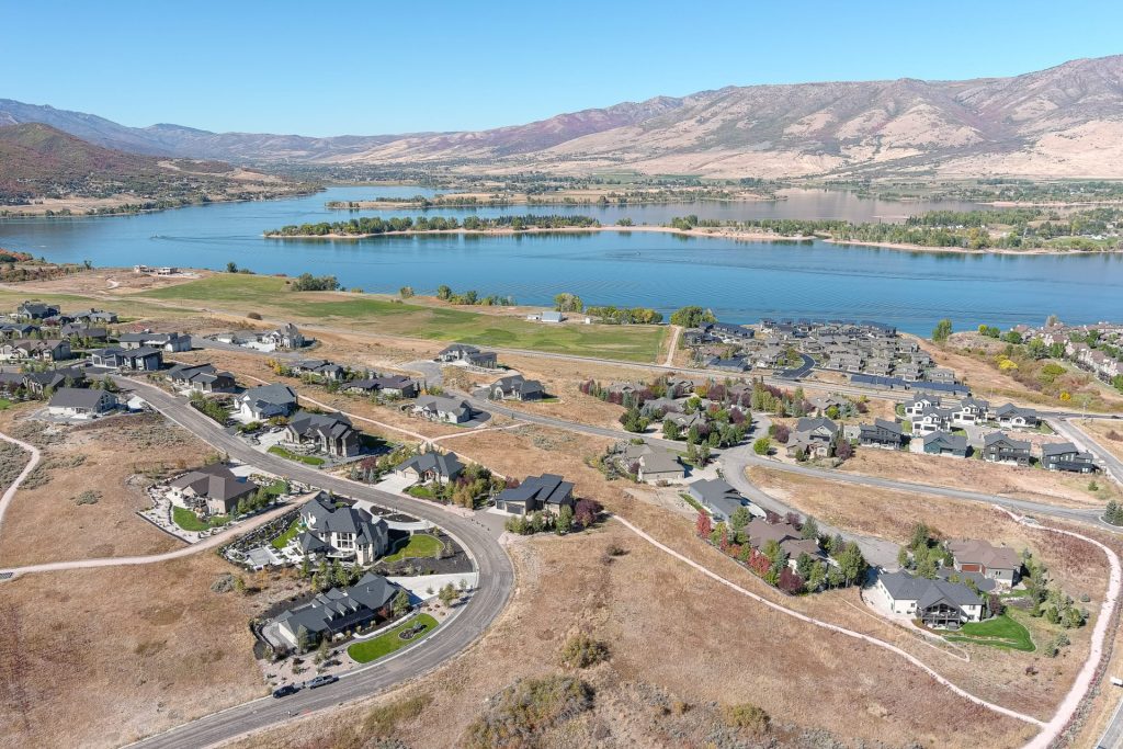
- Show the property in context: Reveal how a home sits within the landscape and relate it to nearby mountains, open space, and community features.
- Communicate scale and layout: Help viewers understand larger lots, acreage, outbuildings, access roads, and outdoor spaces.
- Highlight views and outdoor features: Showcase mountain scenery, patios, landscaping, pools, and other features that may be difficult to capture from the ground.
- Present resort and recreation proximity: Provide a broader visual perspective on a property’s location relative to nearby destinations and amenities, where permitted and accurately represented.
- Create engaging listing videos: Add smooth aerial movement and establishing shots that can make a property’s marketing more immersive across listing sites and social media.
- Support commercial and development marketing: Illustrate site layout, surrounding infrastructure, access, and a project’s relationship to the wider area.
Aerial Marketing for Ogden Valley Properties
Drone imagery can be particularly useful for mountain homes, cabins, vacation rentals, large parcels, luxury properties, and commercial or development projects. For smaller homes or properties where the setting is less central to the sale, ground-level photography may be the priority; aerial coverage can be selected based on the property and marketing goals.
Daniel Jenney Photography combines aerial footage with professional real estate photography to create a cohesive visual presentation. Every drone flight is conducted by an FAA-licensed operator and is subject to FAA regulations, airspace restrictions, local rules, weather, and safety considerations. Availability and permitted flight paths vary by location.
Considering drone photography or video for a property in Eden, Huntsville, or Liberty? Contact Daniel Jenney Photography to discuss the property, your marketing goals, availability, and pricing.